| Home | > | List of locations | > | Khami Ruins, Bulawayo |
Location: Khami Ruins, Bulawayo
General Information
Quarter degree square: 2028A2 Country: Zimbabwe Habitat: Mixed miombo-Acacia woodland and granite outcrops Altitude range: c. 1280 - 1350 m Annual rainfall: Location (short): Location (detailed): |
Description
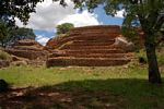
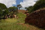
Khami Ruins is the second largest complex of stone walls in the country, after Great Zimbabwe. They were originally constructed between 1450 and 1650 as the capital of the Torwa Dynasty, who ruled their kingdom after the collapse of Great Zimbabwe. The style of dry stone walling is somewhat similar to that of Great Zimbabwe but without large free-standing walls and other constructions. The site is a National Monument and was declared a World Heritage site by UNESCO in 1986. In 2006 an International Youth Volunteer Camp help to restore some of the larger ruins.
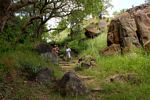
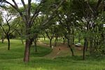
Khami Ruins National Monument is situated c. 22 km West of Bulawayo on a complex of granite hills and outcrops overlooking the Khami River. The vegetation is dominated by mixed miombo and Acacia woodland, often similar to the well-known Matobo Hills, south of Bulawayo. It offers a wide variety of trees, shrubs and herbaceous plants, typical of this rocky terrain, such as Pavetta gardeniifolia, Turraea obtusifolia, T. floribunda, Commiphora marlothii, Pappea capensis, Gymnosporia matobensis and Aloe excelsa.
Useful links
View a list of records for Khami Ruins, Bulawayo
View a list of unique taxa (excluding cultivated plants) for Khami Ruins, Bulawayo
View a list of unique taxa (all taxa whether cultivated or not) for Khami Ruins, Bulawayo
View a list of recorders who have visited this location
| Home | > | List of locations | > | Khami Ruins, Bulawayo |


