| Home | > | List of locations | > | Katombora Islands |
Location: Katombora Islands
General Information
Quarter degree square: 1725C4 Country: Zambia Habitat: Dense riverine vegetation and seasonally flooded riverbanks on basalt and Kalahari sand. Altitude range: c 910m Annual rainfall: Location (short): Location (detailed): |
Description
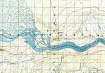
The Katombora Islands are located in the Zambesi River, about 50 km upstream from the Victoria Falls. Most of the island system is in Zambian waters and only a small part is Zimbabwean territory and therefore part of the Western Division. Nevertheless it has proven to be an important showcase of the unique flora on the upper Zambesi.
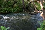
Covering c 5 square kms, the islands are divided by a maze of channels, some no wider than a mountain stream and seasonal, while others are larger perennial river channels. Surrounded by a large complex of white water rapids, caused by several fault lines in the underlying basalt rock, the islands are inaccessible to large game, including elephants. The fishing communities on the Zambian side of the river regard the islands as sacred and have had only minor impact on the island vegetation.
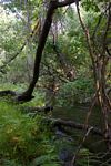
The flora is probably one of the last examples of unspoiled riparian forest on this part of the Zambesi River. Large specimens of Diospyros mespiliformis (Ebenaceae), Garcinia livingstonei (Clusiaceae) and Syzygium guineense subsp. barotsense (Myrtaceae) are common. The understorey is rich in species, including rare trees, such as Homalium abdessammadii (Flacourtiaceae), Croton leuconeurus (Euphorbiaceae) and Turraea zambesica (Meliaceae)
Useful links
View a list of records for Katombora Islands
View a list of unique taxa (excluding cultivated plants) for Katombora Islands
View a list of unique taxa (all taxa whether cultivated or not) for Katombora Islands
View a list of recorders who have visited this location
| Home | > | List of locations | > | Katombora Islands |


